Data-Driven Digital Planning
Laser Scanning
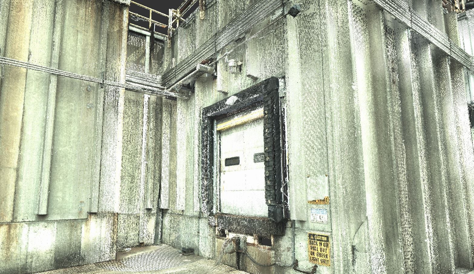
Laser Scanning gives our team a virtually endless number of node points that can be used in 3D CAD models. This helps facilitate constructability reviews and allows for a higher accuracy in locating new geometry and connecting tie-in points. Point Clouds have been crucial in AMG completing projects without field interferences with existing infrastructure.
3D laser scanning provides a high level of accuracy to any project requiring field measurements or as-builts. A 3D laser scan uses a concentrated beam of light to digitally map the surface of any object. The laser sweeps the object to create millions of points called a “point cloud” which is used to extrapolate the object’s shape, location, and even color.
This is ideal for many project field information gathering needs, including (but not limited to) the following:
Why 3D Laser Scanning
Laser scans give our engineers and designers a virtually endless number of node points that can be used in the 3D CAD model to dimension to or design against which helps facilitate constructability reviews and allows for a higher accuracy in locating new geometry and connecting tie-in points. Point Clouds have been crucial in AMG completing projects without field interferences with existing infrastructure.
Providing Point Clouds along with a host of other visual aids during the design phase is extremely helpful in streamlining project reviews with all project stakeholders and providing an even higher level of quality to our clients.
Our professionals visit the facility and post “targets” in various places of the scan area to provide reference points in which to “stitch” multiple scans together. The technician performs various 360o scans from multiple locations to capture all of the desired geometry as the laser scanner is a “line of sight” device and geometry can be hidden if in shadow of another object.
The 3D laser scanner looks similar to a surveyors transit, so as a general rule we budget a minimum 20 minutes per scan for setup/leveling, scan and take down. The number of scans is determined by the amount of area to scan and the complexity of the geometry.